Looking Back at 2025 in Satellite Images
From January to December 2025, significant global events were captured in satellite imagery, highlighting both natural disasters and human conflicts.
January saw devastating wildfires across Los Angeles and San Diego in California, particularly in Altadena, resulting in at least 30 immediate deaths and approximately 440 indirect deaths according to a JAMA study.
In February, the Rapid Support Forces attacked the Zamzam refugee camp in North Darfur, burning buildings and causing civilian casualties.
On March 28, a powerful 7.7-magnitude earthquake struck Myanmar, causing between 3,600 and 5,350 deaths and displacing about 200,000 people.
The funeral of Pope Francis took place on April 26 at St Peter’s Basilica after his death on April 21 at age 88.
May brought reports of GPS interference identified by SAR imagery over Kaliningrad and the Baltic coast.
On June 1, Ukrainian drone attacks damaged the Russian Belaya and Olenya airbases, with high-resolution imagery on June 4 showing the extent of the damage and subsequent cleanup efforts.
Crowds gathered around an aid convoy in south Gaza on July 26, viewed from space; Gaza City was declared in famine a month later.
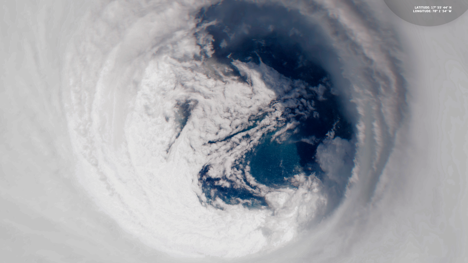
Hurricane Melissa, a Category 5 storm, struck Jamaica on October 28, causing an estimated $8.8 billion in damages, equivalent to about 41% of Jamaica's 2024 GDP. The Copernicus Sentinel-2 satellite captured the hurricane's eye hours before landfall.
The USS Gerald R Ford arrived in the Caribbean on November 16–17 to support counter-drug operations, with satellite imagery off Puerto Rico on November 17 revealing the largest US firepower buildup in generations.
Finally, on December 3–4, New York City's festive lights were illuminated, with satellite imagery capturing the Rockefeller Center Christmas tree lit near St Patrick’s Cathedral on December 3.